
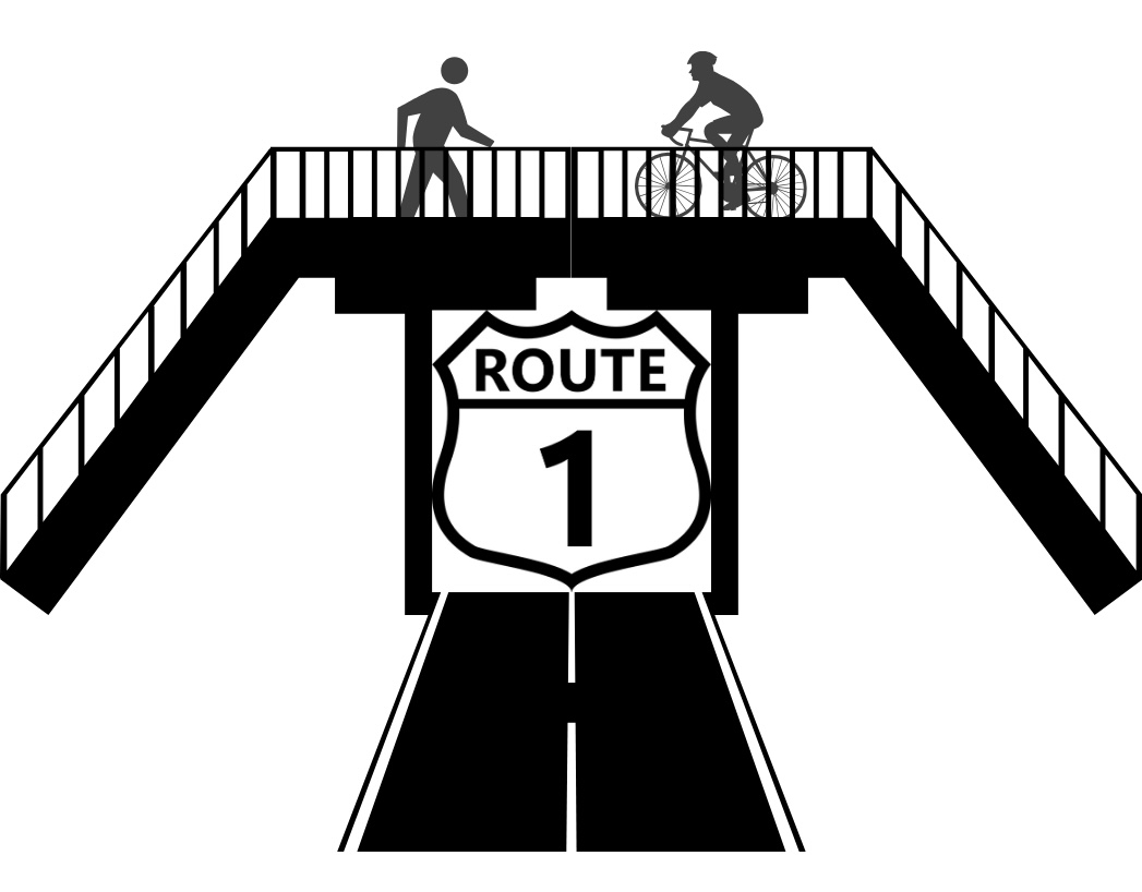
The area surrounding the intersection of Quakerbridge Road and Route 1 in Lawrenceville, NJ, is a major commercial center consisting of the Quakerbridge Mall, the Mercer Mall shopping center, and the Nassau Park Pavilion shopping center. The intersection of Route 1 and Quakerbridge Road has no pedestrian or bike infrastructure, making the area inaccessible to nearby communities. Proposed deliverables include redesigning an existing bridge to accommodate pedestrian and bike traffic as well as creating pedestrian connections to existing shopping centers.
Overview of The Project
The focus of the project was the redesign of the intersection between the Thomas L. Kelly Viaduct and Outer Ring Road connecting Quakerbridge Mall to US-1 in Lawrenceville, Mercer County, NJ. The surrounding area lacks pedestrian connectivity to nearby communities. For the selected alternative, it was proposed that the existing Viaduct Bridge be converted to pedestrian use only, connecting the pedestrian/bicycle lanes from an adjacent residential community to Outer Ring Road. The proposed redesign included an 8-foot multidirectional bike lane and two 4-foot pedestrian lanes. An additional pedestrian bridge with an 84-foot span crossing Outer Ring Road was proposed to the east of the Viaduct Bridge. The following members were proposed: HSS10x6x5/16 (vertical post), HSS10x8x1/4 (diagonal beam), HSS7X4X3/8 (top/bottom chords), W10x26 (floor beam), and W6x25 (diagonal floor beam). Both welded and bolted connections would be used to connect members. A 175-ft access ramp was designed in compliance with ADA standards. The roadway clearance of the proposed pedestrian bridge is 14’-6”. The redesign also included the addition of a road along the southbound side of US-1. To calm traffic, this road was designed with a chicane halfway along its length and a 20-ft radius roundabout where it connects with the US-1 turnoff. It was proposed that the existing Viaduct Bridge and Outer Ring Road intersection be converted to a T-intersection to manage traffic flow. The final engineering services cost for the year was calculated at $44,000. The construction cost estimate for the project was found to be $559,000.
Location of Pedestrian Bridge
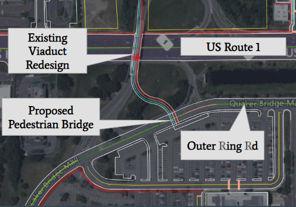
The proposed pedestrian bridge is located on Outer Ring Rd as shown in the image above. It connects directly to the existing Viaduct Bridge which will be redesigned into a pedestrian and bicyclist use only. The roadway clearance of the bridge is 14’6″ and it will have a 175 ft ramp which is ADA compliant.
Geometry of The Pedestrian Bridge
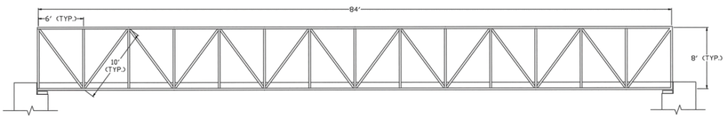
This drawing was completed via AutoCAD. As shown, the bridge has a 84-foot span with 14 panels in between. Within the panels, there is 6-foot top and bottom chords, 10-foot diagonal posts, and 8-foot vertical posts.
Member Schedule
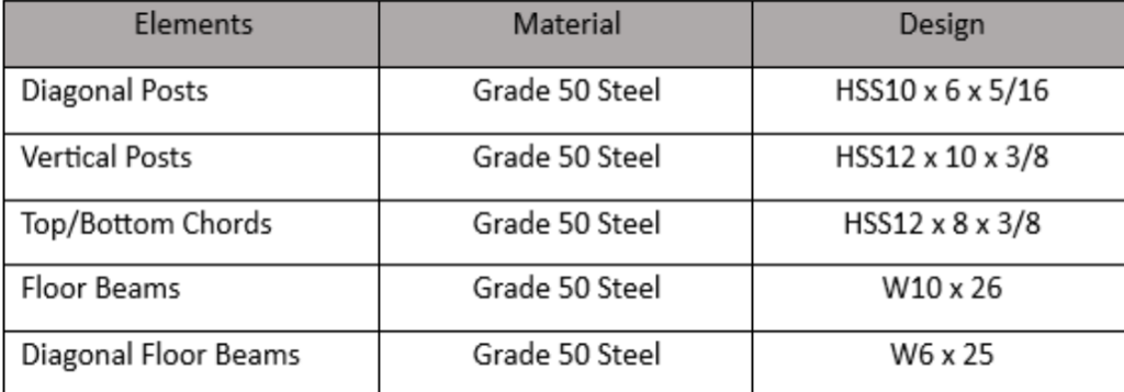
An analysis and optimization of the structure members were done via a program called Visual Analysis. The optimization was based off a unity equation the software uses, which is the ratio between the demand to the design capacity. As shown, the structure has W-shapes for the floor beams and the rest have HSS-tubing.
Connections for The Pedestrian Bridge

The connection for the truss is a welded connection, where the vertical post extends and the other HSS members (cord and diagonal beam) connect directly to the vertical post. We are using 5/16” E70 Fillet weld and welding all the way around. This can be seen in Figure right here, this is the vertical post, here’s the diagonal beam, and the chords.

This model was created using the RisaConnection Software. For the floor beam, it is connected directly to the vertical post via a bolted single plate connection and a bolted moment connection. For the shear, there are two ½” bolts spaced at 2.5 inches with 1.5 inch edge spacing. For the moment connection, there are two ½” bolts spaced at 2 inches with 1.5 inch edge spacing.
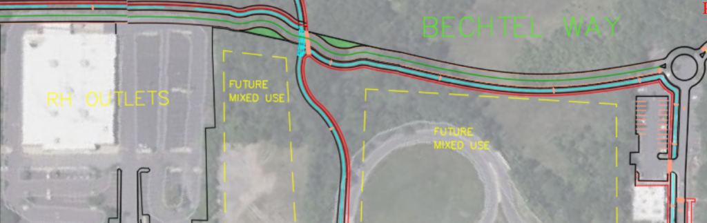
Roadway Geometries
This model shows the proposed roadway for the north side redesign of route 1. The proposed road was name Bechtel way and included many transportation methods. The main method used was a chicane that forced cars to slow down before the crosswalk due to the geometry of the road. The crosswalks are colored and are raised to provide extra visibility as well as a clear indication of crossing. As this alternative removed the on and off ramp from route 1 the space and can be converted into a future mixed use project in the future.
TRAFFIC
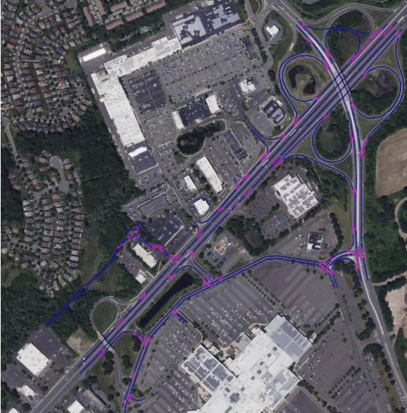
The first choice to develop a traffic model was Synchro 11, with the
understanding that a more detailed model would be created using PTV VISSIM after the basics of the system were modeled. However, the scope of the project proved too large for the student version of Synchro 11 that the design team had access to. With this in mind, PTV VISSIM became the sole modeling program in use for the duration of the design project, and was used to create the figures modeling the proposed conditions below.
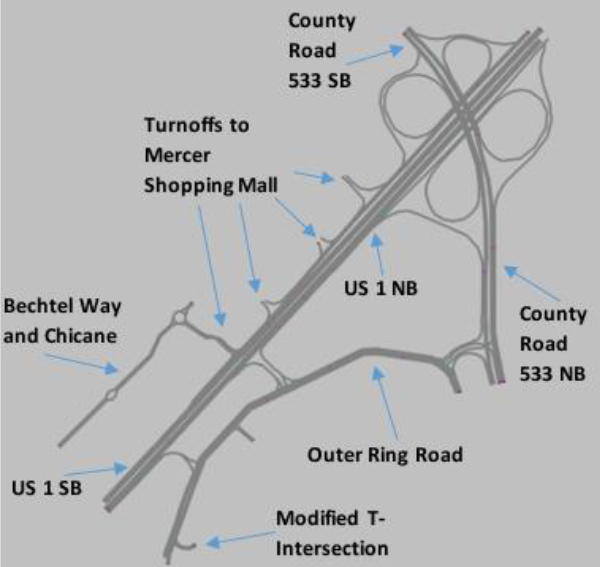
The addition of Bechtel Way connects several businesses along US 1 Southbound
to be connected to the Mercer Shopping Mall. This also provides vehicles a way to reach those businesses without directly turning off of US 1 Southbound. As such, it is projected that the average vehicle traffic on a turnoff to Mercer Shopping Mall will increase from 389 vehicles per hour during peak hours to 442 vehicles per hour during the same time frame. The roundabout at the intersection of a turnoff to Mercer Shopping Mall and Bechtel Way acts as a safety measure for this road, which is projected to see an average traffic volume of 700 vehicles in one direction in one hour during peak hours. 617 of those vehicles are projected to be traveling between Mercer Shopping Mall and the businesses on US 1 Southbound, while 83 of those vehicles are projected to be turning onto Bechtel Way directly from US 1 Southbound.
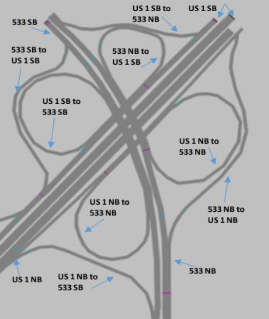
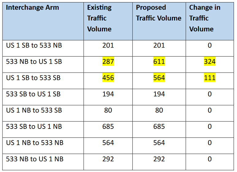
To the east of US 1 Northbound, a portion of Outer Ring Road was modified into
a T-intersection. This design choice was made due to the removal of vehicular
connections to the Viaduct Bridge, and used as an opportunity to realign a Quakerbridge Mall exit with Outer Ring Road. The modification of this intersection increased traffic volumes around Outer Ring Road, as vehicles now have only two exits from Outer Ring Road to either US 1 or County Road 533. Traffic volumes in one direction on Outer Ring Road for one hour during peak hours after the modification were projected to be 401 vehicles. The figure below displays a close-up of the US 1 and County Road 533 Interchange. This interchange would take the traffic volume of vehicles that would have previously accessed the Quakerbridge Mall via the Viaduct Bridge. The table below shows the changes in traffic volumes on this interchange; where the 533 Northbound to US 1 SB link would take the vehicles that would have left the Quakerbridge Mall via the Viaduct Bridge, and the US 1 Southbound to 533 Northbound links would take the vehicles that would have arrived at the Quakerbridge Mall via the Viaduct Bridge. The PTV VISSIM model demonstrated that the affected linkages would be able to support the increased traffic volume without significantly affecting levels of service on either US 1 or County Road 533.
Engineering Services Presentation
https://acrobat.adobe.com/id/urn:aaid:sc:VA6C2:d91a08f4-1c2e-4c50-8b2a-a939d4b6b643