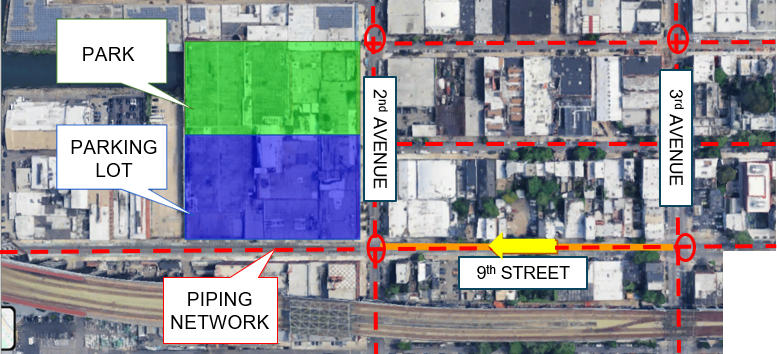
Throughout the fall semester, significant progress was made in data collection, site analysis, and the development of design solutions to improve hydrological and transportation conditions to 2nd and 3rd Ave. In both areas, three alternative designs were proposed to advance public safety. The existing Site layout is shown in the image below.
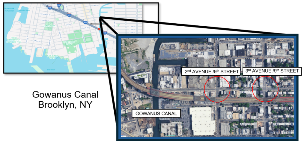
The intersections at 9th Street and 2nd and 3rd Avenue experience heavy congestion with traffic volumes at 10889 AADT, limited pedestrian safety infrastructure, and insufficient accessibility for Americans with Disabilities (ADA). The objective of this project is to develop an integrated hydrologic and transportation design that improves drainage efficiency and enhances multimodal traffic flow.
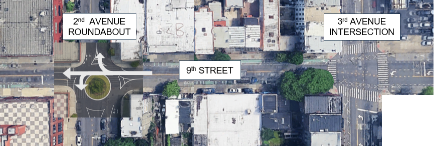
The first alternative adds a continuous roundabout with a center median along Ninth Street. Roundabouts at Second and Third Avenue would reduce stop-and-go traffic and improve flow. The median would limit left turns, improve safety, and give pedestrians a protected waiting area.
The second alternative uses a one-way roundabout at the 2nd Avenue intersection, with Ninth Street also operating one-way. This design improves traffic flow and reduces congestion by replacing a standard intersection with a smoother, curved layout. The roundabout reduces conflict points and makes merging easier. Slower speeds and clear crosswalks also improve safety for pedestrians, cyclists, and drivers.
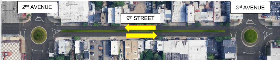
The third alternative makes Ninth Street a Complete Street and converts it to a one-way road. The intersection would be upgraded to ADA standards, and new features like a median, bike lanes, and bollards would improve safety for cyclists and pedestrians. A dedicated bus-only lane would support frequent transit use, and a new parking lot would help reduce illegal or unsafe street parking. Added trees and green space would improve sustainability and create a more pedestrian-friendly environment. Vehicle movement would be limited so it doesn’t overpower pedestrian and cyclist activity.
Traffic counts along 9th Street showed high pedestrian and bicycle use along with moderate traffic volumes. For these reasons, Alternative Design 3: Complete Street was chosen because it focused on the safety of pedestrians and cyclists, calming traffic, and sustainability for the future with good vehicle throughput.
To evaluate the most optimal stormwater mitigation design alternative, a watershed analysis was conducted at the Gowanus canal site. The hydrological modeling programs HEC-HMS and HEC-RAS, both widely used in industry, were utilized to simulate conditions of a 24‑hour, 100‑year storm event. Based on this storm event HEC-HMS estimated a peak discharge of 2875.4 cubic feet per second and direct run-off volume of 1001.6 acre-feet. HEC-RAS was able to determine that during the 24-hour 100 year storm event the peak discharge would be about 1403.76 cubic feet per second. These results influenced the decision to redesign the existing piping network to more effectively accommodate increased stormwater capacity, especially during extreme weather events.
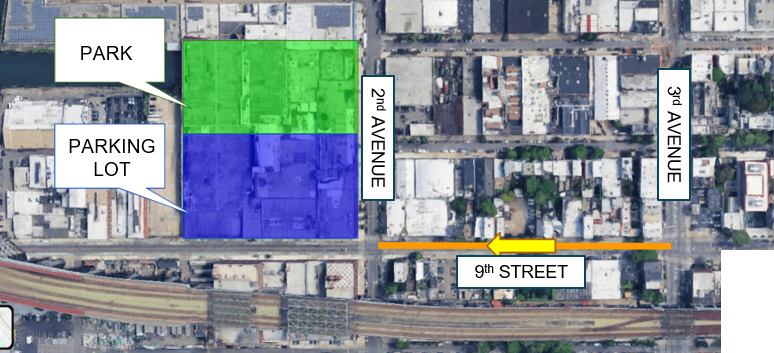
The selected design alternative for the selected transportation improvements as well as the hydrological alternative is depicted in the provided image. The potential piping redesign geometry is included within the image in the form of red dotted lines. Additionally, the placement of the proposed park shaded in green and proposed parking lot shaded in blue are also indicated.
The team concluded the semester with a final fall presentation of engineering services, which can be accessed through the link below.