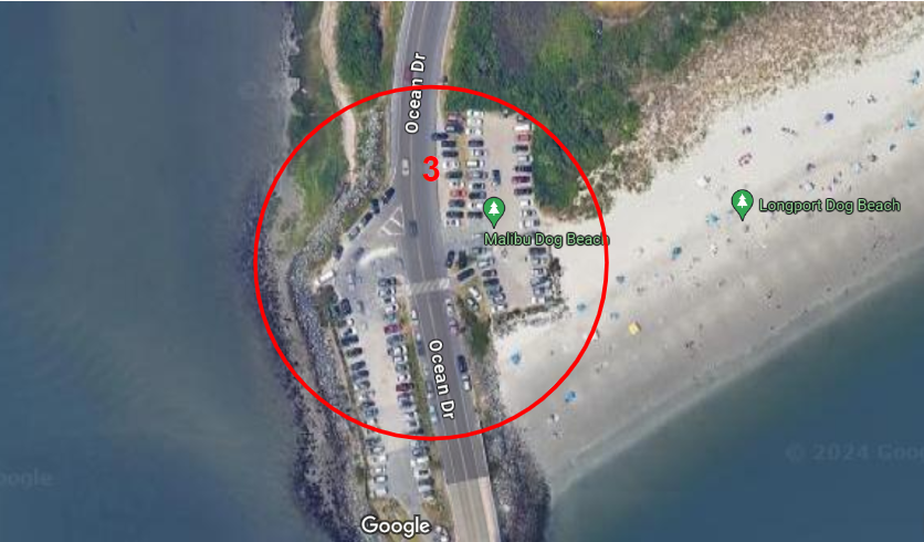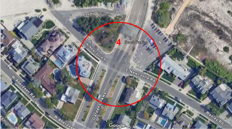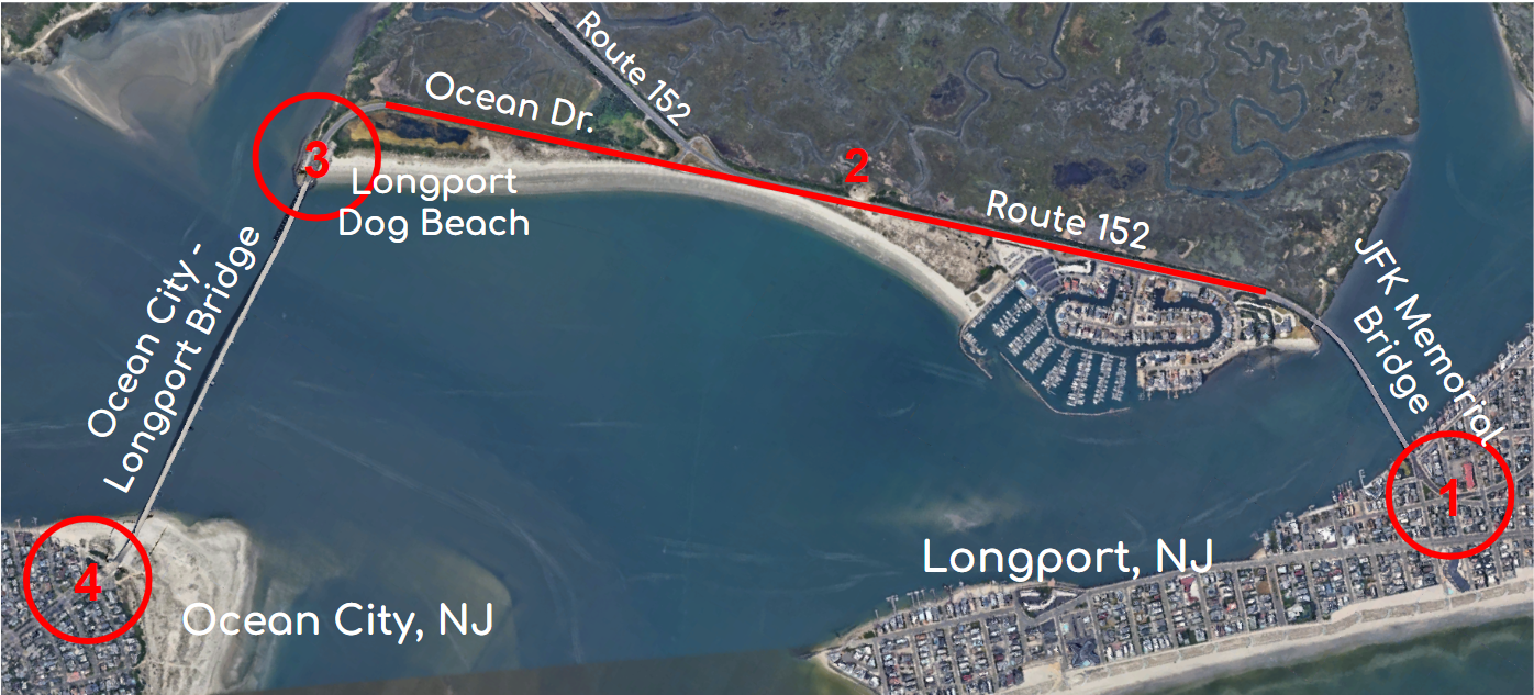
The corridor between Longport and Ocean City, NJ consists of two bridges and a wildlife management area that connect the towns by road. Each of the bridges join at intersections on their respective islands, merging commuters in with town traffic. On the east end of the JFK Memorial Bridge is the first intersection (site 1), where Ventnor Ave., Oberon Ave., and 28th Ave. all intercept. On the south end of the Ocean City-Longport Bridge is the second intersection (site 4), where Ocean Dr. converts to Gardens Pkwy., intersecting Newcastle Rd. Both of the aforementioned intersections are confusing and convoluted, posing a risk to unknowledgeable drivers and pedestrians alike. The Longport Dog Beach resides at the north end of the Ocean City-Longport Bridge. Upon observation, the dog beach parking lot (site 3) is undersized for the amount of reception the park attracts. Both lots fill up and the overflow parks along both shoulders, constricting the road for vehicle traffic and completely cutting off cyclists and pedestrians, who only have the shoulder as their bike lane. On a similar note, Route 152 into Ocean Dr. (site 2) is a 40mph straightaway, with wide lanes and shoulders. Reckless driving occurs frequently because of these forgiving conditions, putting any cyclists or pedestrians using the shoulder in unnecessary danger.