Tuesday: April 23rd, 2019: Traffic Counts into Synchro
From the peak hour traffic counts that were conducted, they were implemented into synchro for a simulation. Although the image taken isn’t identical to the design (since it cannot be drawn in the software) it has been deemed adequate.
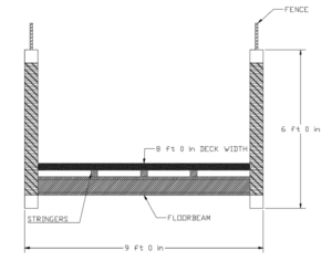
Monday: April 22nd, 2019: Bridge Cross Section
Below shows a cross section of the pedestrian and the HSS sections that will be used.
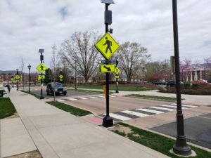
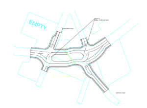
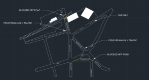
Tuesday: April 16th, 2019: Pedestrian crossing of peanut
In our drafts we depict how the pedestrian crossing will be oriented however the image below shows the signage for the area.
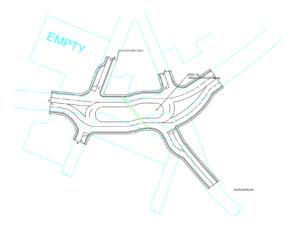
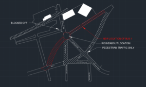
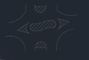
Sunday: March 24th, 2019: Update to Roundabout
Photograph below represents existing conditions (cyan) with the proposed roundabout (black) along with where the crossing path would be.
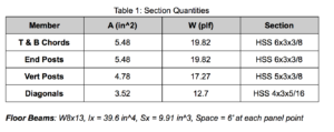
Saturday: March 23rd, 2019: Load Calculations for Pedestrian Bridge
Calculations for the half-through truss bridge are in progress as well as the design of how many members for the bridge. Image below shows sample calculations for the proposed bridge.

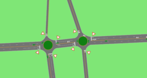
Monday: March 4th, 2019: Peanut Round About over existing conditions
Updates to the round about are shown below. Solid black lines represent the proposed design while the cyan represent the existing.
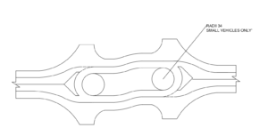
Thursday: February 14th, 2019: Drafting of proposed round about
Exciting news about the roundabout for Penndel, PA! Drafting has begun and here’s a glimpse of the draft coming along!
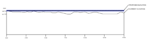
Wednesday: February 13th, 2019: Elevations for BUS-1
Our team has proposed a new elevation for the roundabout and listed the current elevations for the site.
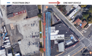
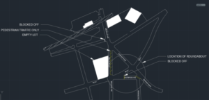
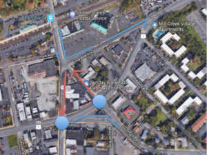
Saturday: November 25th, 2018: Bellevue changes for Farmer’s Market
In accommodation for the farmer’s market suggested for the empty lot depicted in the photo below, the transportation team has outlined changes to Bellevue Ave. The red arrows depict one way vehicle only traffic while the blue depicts pedestrian only traffic. The road will be split for vehicle and pedestrian traffic for the farmer’s market. Adding elements for transit-orientation.
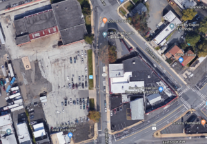
Tuesday: November 13th, 2018: Empty lot suggested as a farmers market.
In the shot below taken from Google has a vacant lot next to Bellevue avenue. From the previous blog post, we suggested inputing a store in the location to incorporate additions for the transit-orientation. A store would allow an increase in vehicle and pedestrian traffic into the area.
Tuesday: November 6th, 2018: Alternative Designs (Transportation Team) in CAD
In the images below depict the alternative designs in a CAD format.
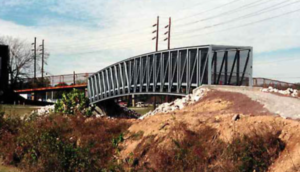
Wednesday: October 31st, 2018 Bridge
The bridge below represents a gateway truss design for the pedestrian bridge. This type of bridge is the most common for pedestrian traffic over train tracks due to the canopy protecting the concrete walkway from rain, snow,etc. In this design there will be towers on each side to make this ADA compliant.
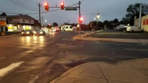
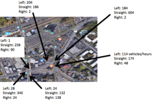
Tuesday: October 23rd, 2018 Traffic Counts
Traffic counts were taken for one hour at each intersection. BUS-1 traffic counts were taken for peak times 4:30pm-5:30pm while the other intersections were taken for the hour after. The values displayed below represent how many vehicles per hour traveled through.
Thursday: October 4th, 2018 ROUND-ABOUT-PEANUT
For the transportation team, the emphasis of the senior project is to design the peanut style round-about. The photos below depict the location of the round-about as well as a sketch of a potential design for it. Traffic counts will be taken at the next site visit.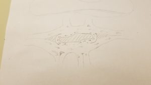
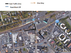
Saturday: September 22nd, 2018 DESIGNING
Alternative designs are coming into play for the roadway and pedestrian foot traffic. One of our designs is to block off the roadway crossing the tracks. We understand there are two bus routes which go along this route however they can be re-routed. The photo below explains another potential design.
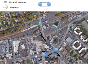
Tuesday: September 18th, 2018 DESIGNING
The roadway design that is depicted below as an image represents two roundabouts as well as ends of roads. The blue shape is where we would block off a certain road. As for the shopping plaza, we would remove one of the two entrances, and keep one flow of traffic in and out. As for the red arrows, they show a roadway of one way of traffic.
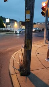
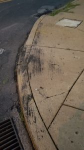
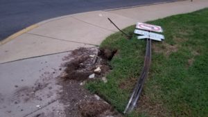
Thursday: September 13th, 2018 SITE VISIT
The site visit consisted of walking the entire area of the project as well as driving through all the roads and intersections. Multiple issues were found such as poor turning radius for many intersections, blind spots around buildings, utility poles in the concrete sidewalk, a utility pole that has evidence of being hit by a vehicle, etc. The photos below were taken during the site visitation.