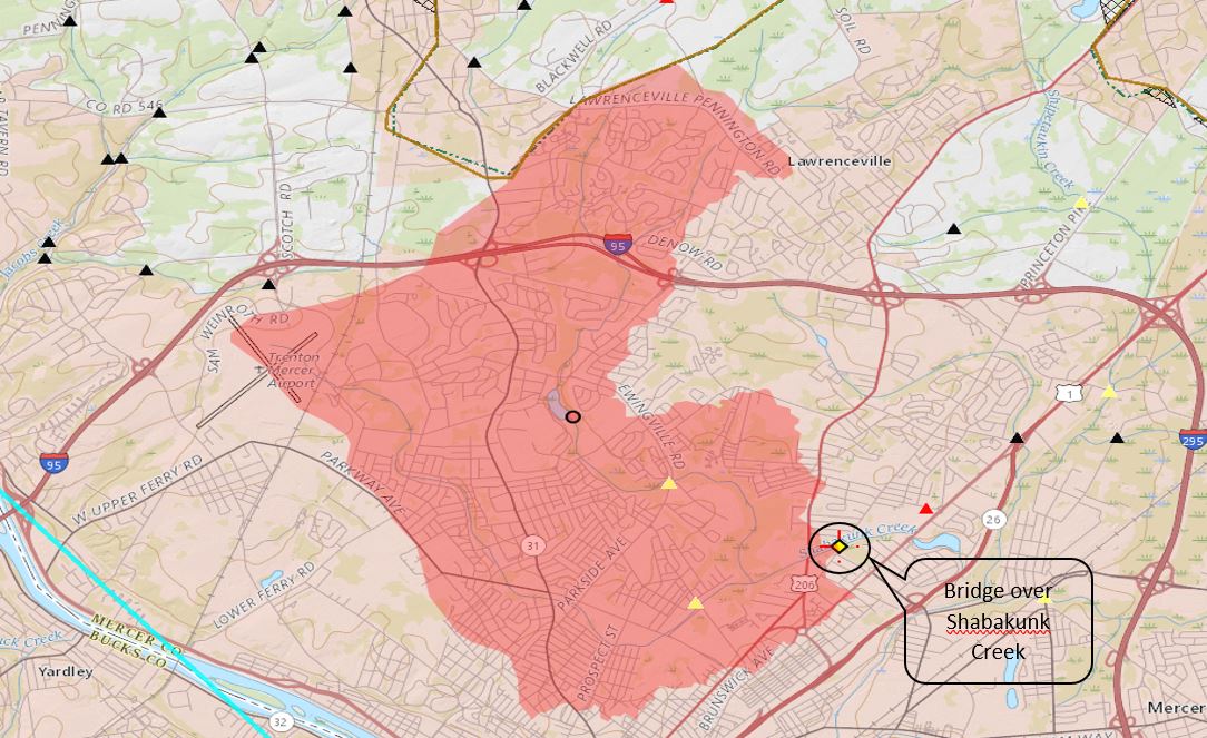
The area of the watershed for Shabakunk Creek was calculated from a delineation point at Bridge No. 541.2 using Streamstats PA. The watershed area is 11.7 square miles. It has an average basin slope of 2.09% . A curve number of 79 was calculated from WebSoilSurvey. 
Monthly Archives: October 2017
Field Data
Update #1
Over the past two weeks, the team has met with Dr. Brennan and Dr. Horst on a few occasions to discuss the future of the project. Overall, the team has been working on an overall sight plan for the area of interest. Marc and Szymon spoke with Dr. Brennan to obtain .SID files to accurately measure the street and horizontal curves of the area on interest. Jack spoke with Dr. Horst, and is working on creating a synthetic unit-hydro graph for the water shed area of the bridge in question.


