All posts by Maxx Dufficy

Bridge Shape

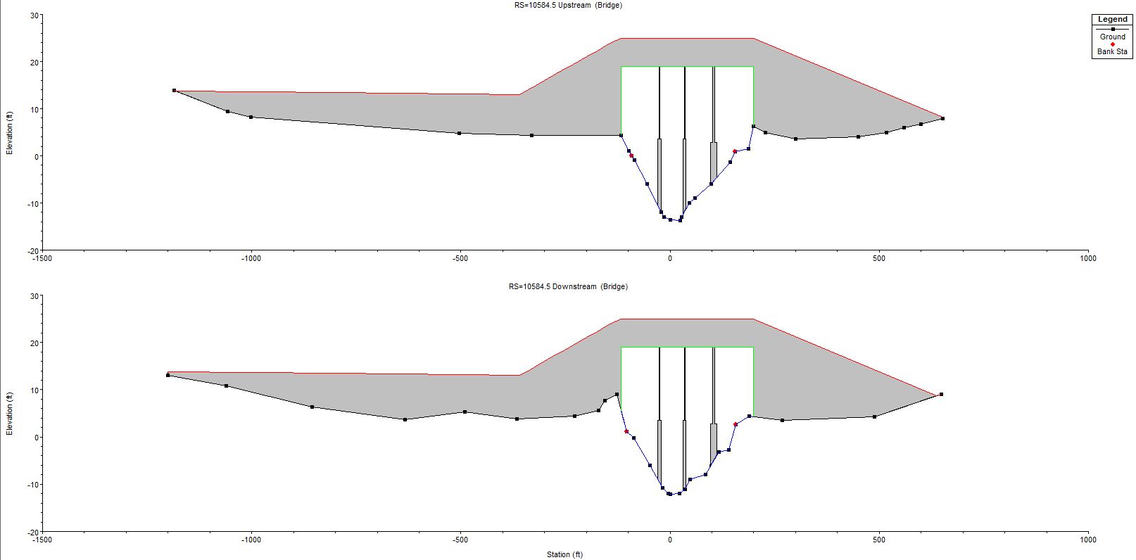
With the inputs finished into HEC-RAS, the minimum height of 12′ above high tide was kept.  The mean sea level is 0′, plus the high tide at 7′.  This puts the low chord of the bridge at 19′.  Even though the current model shows a pile design, the pile design is not complete.  Once a pile design is selected it can be inputted into HEC-RAS and the scour can be ran on the model.


Brige shape with old piles

HEC-RAS

Design of the hydrological portion has begun. The bridge will be designed according to a 100 year storm along with high tide. The scour of the piles will be designed using a worst case scenario of a 500 year storm. Not only will the low chord of the bridge be designed for a 100 year storm but the asked height of 12 foot from the water level will be kept in mind for high tide.

Watershed Properties and Flow

The last of the watershed properties were found.  The average slope was found to be 5.26% and the longest hydraulic length was found to be 30,750 feet.  These two were found using four topographic maps.  Using the SCS time of lag, the time of lag was calculated to be 2.422 hours.  With all of the watershed properties the peak flow was found using HEC-HMS.  The flow was found to be 3,157 cfs.  This was done using a c value of 150.

Watershed Curve Number (CN)

After using Streamstats to determine the watershed area, a .SHP file was saved and uploaded to Web Soil Survey.  The watershed characteristics were transferred and the soil types were determined.  After using the soil types and the land use an overall CN was determined to be 76.