The last of the watershed properties were found. The average slope was found to be 5.26% and the longest hydraulic length was found to be 30,750 feet. These two were found using four topographic maps. Using the SCS time of lag, the time of lag was calculated to be 2.422 hours. With all of the watershed properties the peak flow was found using HEC-HMS. The flow was found to be 3,157 cfs. This was done using a c value of 150.
Monthly Archives: November 2015
Alternative Design
After considering the realistic and design constraints, alternative design options were considered for the soil remediation, embankment design, abutment design, and foundation design of the Monmouth County MA-14 Bridge. For the soil remediation, both preloading and wick drains were considered as a method to accelerate the consolidation of the organic clay layer in the soil profile. Embankment design is governed by consolidation and slope stability, and the slope stability methods considered were geo-textile reinforcement or a retaining wall design. For the abutment design a retaining wall option was considered, which would work in conjunction with a sheet pile bulkhead design. Lastly, considering shallow foundations do not perform well in cohesive soil conditions deep foundations were selected as the only reasonable design. Deep foundation solutions such as driven piles and drilled shafts were assessed for the optimal design option.
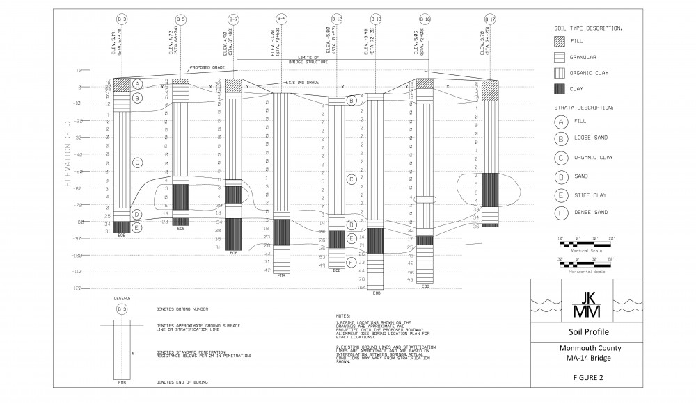
Soil Profile
The geotechnical team has finalized the soil profile. The ground water table, existing and proposed grades lines, as well as the bridge limits are now included as well.