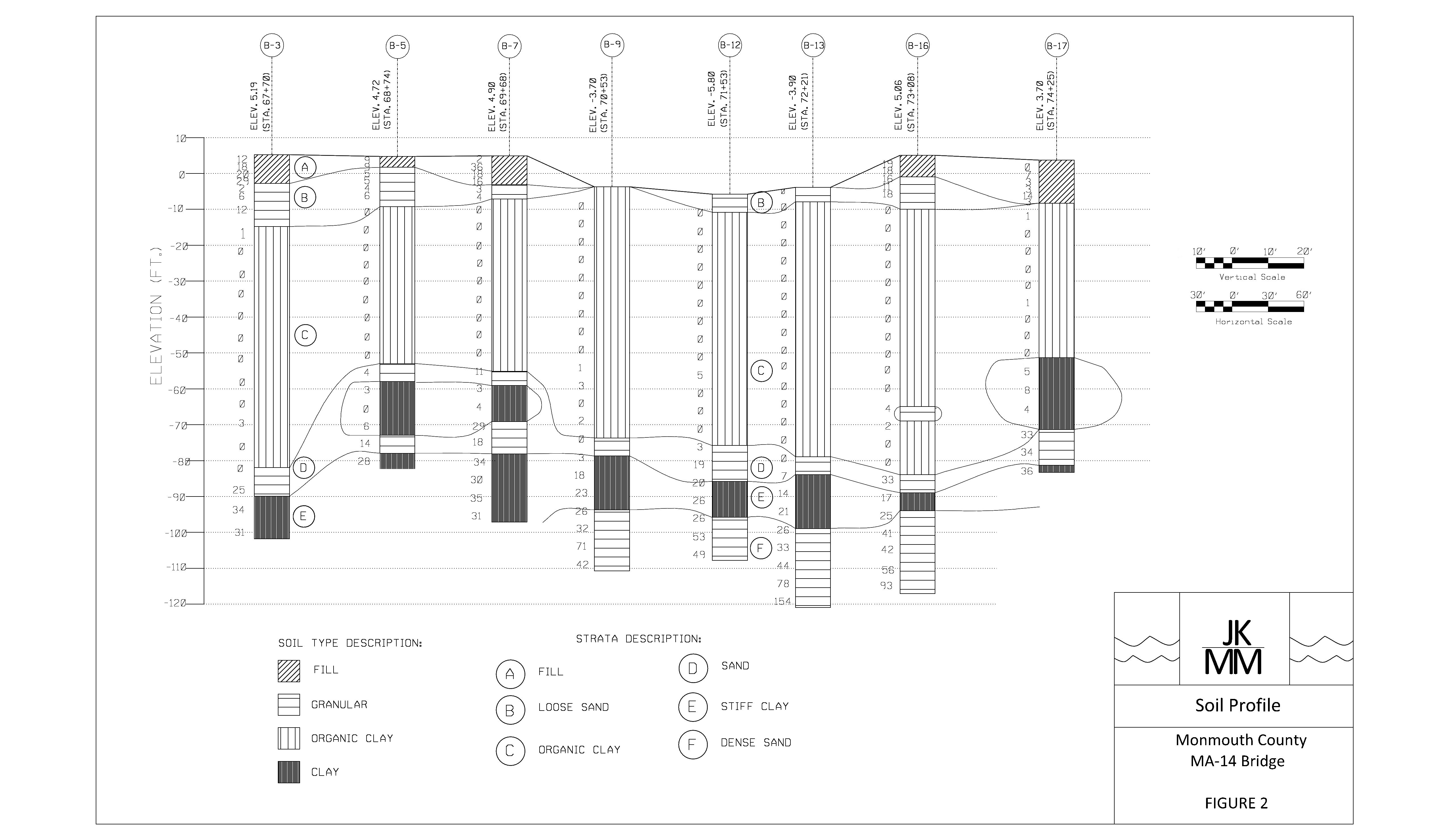
The geotechnical team has finalized the soil profile. The ground water table, existing and proposed grades lines, as well as the bridge limits are now included as well.
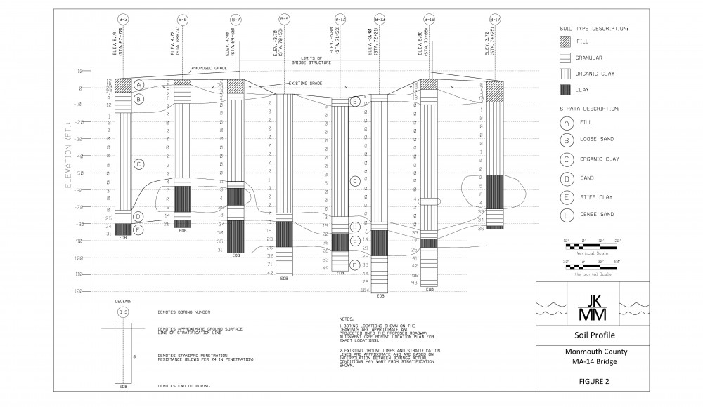

The geotechnical team has finalized the soil profile. The ground water table, existing and proposed grades lines, as well as the bridge limits are now included as well.
After determining the soil profile, soil properties for each stratum were calculated. For the cohesive layers (C and E), laboratory test results for unit weight, compression ratio, recompression ratio, pre-consolidated stress, and cohesion provided by TerraSense were averaged. For the granular layers (A,B,D,F), the unit weight, angle of friction, bearing capacity, and compression ratio were calculated by empirical graphs using the average SPT value for each individual layer.
|
Stratum |
Unit Weight (pcf) | Angle of Friction (degrees) |
C’ |
CR |
RR |
Pre-Consolidated Stress (ksf) |
Cohesion (ksf) |
| A | 110 | 33 | 68 | 0.014 | |||
| B | 100.00 | 31 | 46 | 0.022 | |||
| C | 93.82 | 0.287 | 0.03 | 1.6-4.0 | 0.46 | ||
| D | 120 | 33 | 55 | 0.018 | |||
| E | 119.5 | 0.119 | 0.03 | 21.8 | 1.76 | ||
| F | 130 | 39 | 95 | 0.011 |
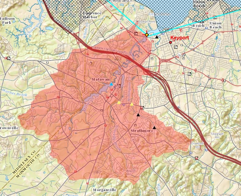
After using Streamstats to determine the watershed area, a .SHP file was saved and uploaded to Web Soil Survey. The watershed characteristics were transferred and the soil types were determined. After using the soil types and the land use an overall CN was determined to be 76.
The team created a soil profile using the selected boring logs explained in the site plan update. The soil was separated into 6 strata. The top layer consisted of fill while the next layer was comprised of loose sand. The largest of the strata was the organic clay which was approximately 60 feet thick located at an elevation of about -10 feet. After the organic clay, a thin layer of sand was present followed by a stiff clay layer. The lowest layer explored was a dense sand layer approximately 95 feet deep.
The team developed a site plan which includes the locations of the boring logs used for the soil profile. A conservative design approach was used while selecting which borings to use for the profile. Of the sixteen boring logs available, eight were located on the westbound side while the other eight were directly across on the eastbound side. The eight that were chosen for each location along the bridge contain the poorest soil conditions.

Using Stream Stats to pinpoint the bridge location on a map, the watershed which contributes to the creek is approximately 12.9 square miles. Below is the map of the area.
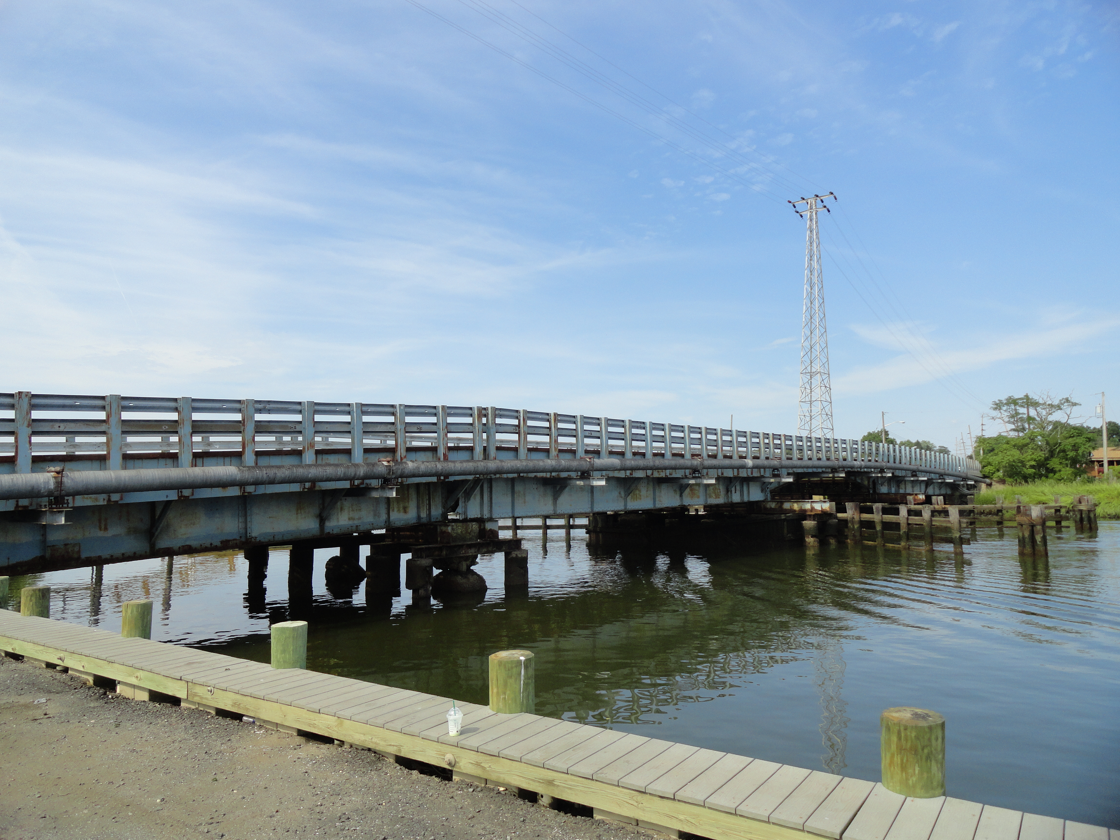
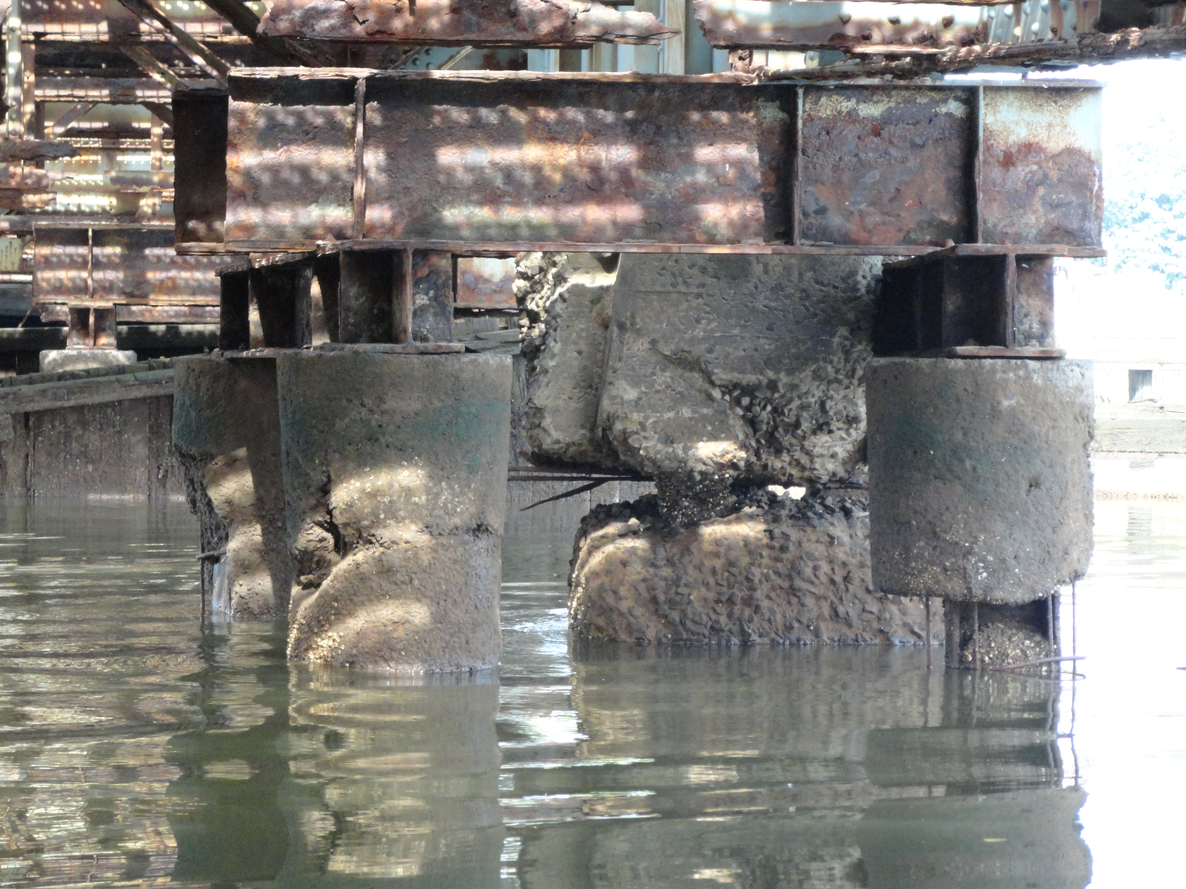
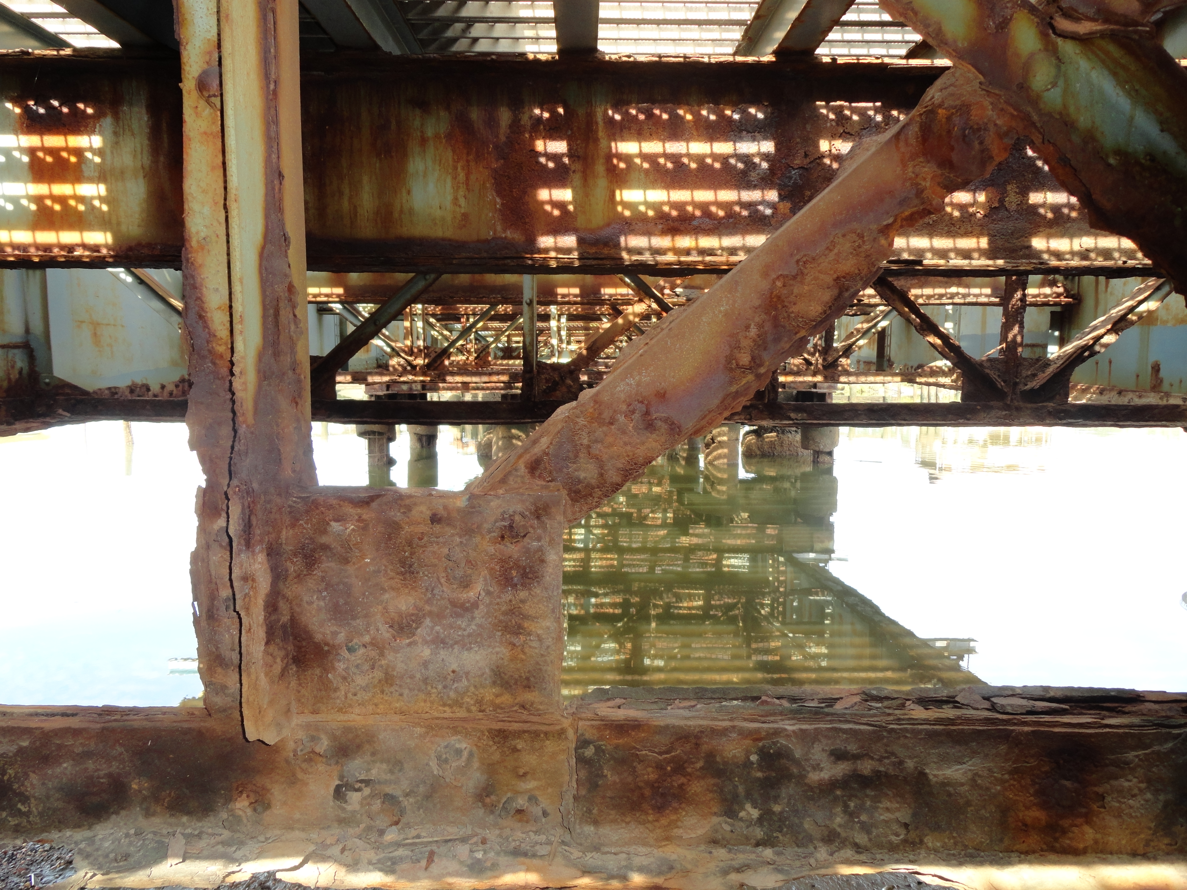
On Monday August 24th, our team went to visit the site of the Monmouth County MA-14 Bridge. With the help of our Industry Advisor, Joseph Strafaci, we were able to examine the structural integrity of the bridge and get a realistic view of the surrounding area. As a result of this first site visit, our team has a better understanding of the design constraints as well as what improvements should be considered for our final design.